Post Graduate Diploma in Geo-Informatics
Exclusive addons is collaborative project of some professional developer, designer & tested user experience of using it on some of user’s websites.
Course Information
Course
Post Graduate Diploma in Geoinformatics
Affiliation
ITT Council, New Delhi
(International Valid Diploma and Certificates)
Duration
12 Months
Eligibility
Graduate orn Persuing
Fee Structure
Rs. 49,000/-
Mode of Training
Online/Offline
ADMISSION OPEN 2024-25
Become A GIS Expert
With Our Geoinformatics Specialization
Explore Our GIS and Remote Sensing Programs
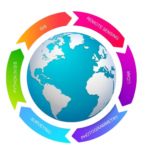
Course Technologies covered

Absolutely! A quality student deserves a quality education.
Absolutely! A quality student deserves a quality education.
PG Diploma in Geoinformatics
About the Course
Do you like to put your texts on solid color? Leverage the rounded color style accordion
Geoinformatics is the blend of various technologies, namely, GIS, remote sensing, photogrammetry, cartography, GPS and geodesy. It is fundamental to all the disciplines, which use data identified by their locations. Geoinformatics deals with spatial and non-spatial data, their methods of acquisition, management, analysis, display, and dissemination. Applications of geoinformatics are mainly oriented to solve real world problems pertaining to natural and man-made environments
The one year Post Graduate Diploma in Geoinformatics aims to provide conceptual knowledge on GIS, remote sensing and related fields, and hands-on training in GIS, remote sensing data interpretation, digital image processing, digital photogrammetry, digital cartography, webGIS, GPS,2D and 3D drafting
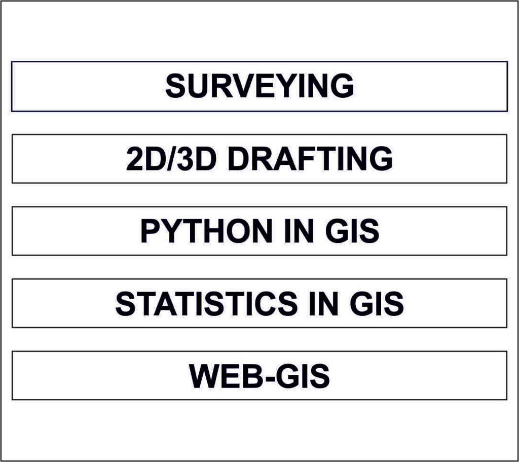
Course Curriculum
Download Brochure for complete details
Semester- I
Introduction to Computer languages used in GIS, Python in GIS, Introduction to Python, Features of Python, Data types, Why python, Understanding basic concepts, Python Interpreter, Python Distribution, Class, Object and functions, Understanding tools of Vector data analysis & Python Scripting for Vector data analysis.
Introduction to map, Importance of computer mapping, Parameters of map, Concept of projection, coordinate system and datum, Map generalization, Map interpretation.
GIS data type, GIS data model, Accessing GIS data, Creating Data, Evaluation of GIS data, working with attribute data & Data exploration.
What is spatial analysis, Solving spatial problem using GIS, Geo-processing and analysis, Spatial data editing, Spatial analysis, Geo-statistical analysis – Spatial interpolation, AHP, Understanding 3D analysis in GIS, Performing 3D analysis using Digital Elevation Model (DEM) data & Hydrological Analysis using DEM data.
Concepts and principles, Geospatial web services and mashups, Introduction to Geo server, Open Geospatial Consortium protocols – WFS, WMS, WCS & WPS & Layer creation & Linkage.
Semester - II
Statistics : Introduction to statistics, Collection of data – Primary and Secondary data sources, Measurement of central tendency – Mean. Median and Mode, Measures of variations, Mean deviation and Standard Deviation, Hypothesis – Meaning and uses, Sampling techniques, Correlation & Regression Analysis.
DBMS : Introduction to DBMS, DBMS file types, SQL Query and Operators
Basic principals of remote sensing, Electromagnetic spectrum , Optical, thermal and microwave remote sensing, Concept of sensor, platform and satellite , Remote sensing satellites and data products, Remote sensing data and correction, Image interpretation
Understanding digital image, Image enhancement, Preprocessing and Post Processing of remote sensing data, Image classification – Supervised, unsupervised and object based classification, Accuracy assessment, Change detection, Data merging and GIS integration
.
Aerial Photography – Geometric characteristic of aerial photographs, Photogrammetry – Defination and development of photogrammetry, classification and uses of photogrammetry, Photographic scale, Working with aerial phototgraphs , Ortho Photo Generation & Creation of DEM/DTM.
Fundamental of Lidar, Types of Lidar (Airborne , Terrestrial and Mobile), Lidar data processing and classification, Lidar Application and analysis.
Introduction to drafting software, Creation of data, Data conversion in GIS software.
Planning a project, Implementation of Project & Management of project